
Peru / Cusco region
Machu Picchu
An Inca settlement where stonework and terraces meet a dramatic mountain landscape.
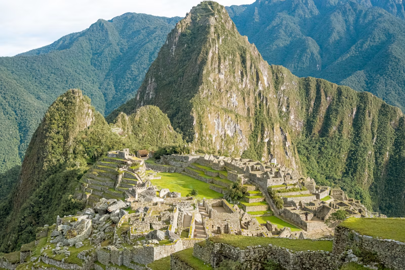
Making level ground on a ridge
At roughly 2,430 metres above sea level, Inca builders set terraces, stairways and buildings into a steep mountain landscape. From a distance the town seems almost continuous with the ridge. Follow a single terrace across the slope and you can see how much work went into creating a level surface. Much of the settlement had to be made habitable before a wall could rise on it. [1]
A sanctuary beyond the stonework
The World Heritage sanctuary includes the mountain forest on the eastern side of the Andes as well as the stone settlement. Look for the boundary where the terraces meet vegetation, then follow the fall of the land beyond it. The conservation area protects a natural setting as well as a cultural landscape. Both are essential to understanding how this town occupied its ridge. [1]
Choose a route by what you want to see
Official route diagrams distinguish panoramic visits from routes that pass closer to buildings. Pick one detail you would like to examine, such as the outline of a terrace from above or a wall at walking height, then check it against the diagram. A single ticketed route need not connect every viewpoint you remember from photographs. [2]
Look for this on site
Find a stairway crossing several terraces. Compare its upward course with the horizontal bands beside it. The same slope provided routes for people and flat surfaces for planting.
Before visiting
Before booking, check Peru’s official route maps and the information for your visit date. Some routes are seasonal and routes may have a prescribed direction.
Timeline
- 15th c.
- Inca builders establish the mountain settlement.
- 1983
- The site is inscribed for both cultural and natural heritage.